GOES Satellite Data - VISSR/VAS (GOES-7 and earlier)
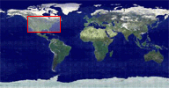
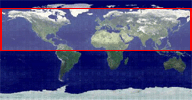
Area_of_Interest
|
||||||||||||
BandsIdentifiers mapped to wavelengths corresponding to the data. In the initial short-term pre-GOES-8 delivery implementation, individual IR bands cannot be selected for delivery. If IR is selected, all of the infrared bands will be included. There is only one visible band for pre-GOES-08 data |
||||||||||||
Data SourceCode internal to CLASS for the source of Pre-GVAR data. |
||||||||||||
Data Usage Guidance/RestrictionsThe operational data for this datatype is available to all registered CLASS users. Pre-operational data may be restricted to authorized users. To become an authorized user, send a request to the CLASS Help Desk. |
||||||||||||
Dataset Max LatitudeThe latitude of the northernmost pixel of the dataset. |
||||||||||||
Dataset Max LongitudeThe longitude of the westernmost pixel of the dataset. |
||||||||||||
Dataset Min LatitudeThe latitude of the southernmost pixel of the dataset. |
||||||||||||
Dataset Min LongitudeThe longitude of the easternmost pixel of the dataset. |
||||||||||||
Dataset NameThe name of the MODE AAA data set archived at CLASS. The name has the following format: <Satellite ID>.<Year>.<Julian Day>.<Start Time>
|
||||||||||||
Dataset SizeThe size in bytes of the file to be delivered to the user. |
||||||||||||
End TimeThe UTC date and time corresponding to the end of the coverage of the given dataset. Format is yyyy-mm-dd hh:mm:ss.fff where fff is the fraction of a second in milliseconds. |
||||||||||||
Include Digital SignatureThis is a feature of CLASS that verifys the data is from CLASS via a digital signature option selection in the User Preferences. |
||||||||||||
Ingest StatusThe state of the dataset's ingestion process.
|
||||||||||||
Ingest TimeThe UTC date and time that the dataset was ingested. Format is yyyy-mm-dd hh:mm:ss |
||||||||||||
Inventory IDA unique numerical ID assigned to the dataset for CLASS inventory purposes. |
||||||||||||
Northernmost ScanlineThe line number of the northernmost pixel in the dataset. Lines are the index for the vertical axis of a scan. |
||||||||||||
Output FormatThe valid formats are:
|
||||||||||||
SatellitesAbbreviation that identifies the satellite that acquired the dataset. Listed below are the definitions of the abbreviated satellite IDs:
|
||||||||||||
Southernmost ScanlineThe line number of the southernmost scanline in the dataset. Lines are the index for the vertical axis of a scan. |
||||||||||||
Start TimeThe UTC date and time corresponding to the beginning of the coverage of the given dataset. Format is yyyy-mm-dd hh:mm:ss.fff where fff is the fraction of a second in milliseconds. |
||||||||||||
Sub ModeInstrument flown on GOES-04 through GOES-07 can operate in 3 different sub-modes: VISSR, MSI, and DS. |
||||||||||||
Subpoint LatitudeThe latitude of the point on Earth that is directly below the satellite. |
||||||||||||
Subpoint LongitudeThe longitude of the point on Earth that is directly below the satellite. |
||||||||||||
TemporalRefers to the time span of interest to the user. This section of the search page allows the user to define the range of dates/times of interest. |
||||||||||||
UTCCoordinated Universal Time (UTC) is the international time standard. It is the current term for what was referred to as Greenwich Meridian Time (GMT). Zero (0) hours UTC is midnight in Greenwich England, which lies on the zero longitudinal meridian. Universal time is based on a 24 hour clock, therefore, afternoon hours such as 4 pm UTC are expressed as 16:00 UTC (sixteen hours, zero minutes). |
||||||||||||